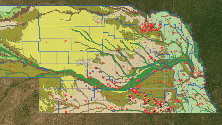
With funding from the Nebraska Environmental Trust (NET), Nebraska Department of Environment and Energy (NDEE), and several Natural Resources Districts (NRDs), NWC launched the Nebraska Vadose Zone Program in 2015. The program, nearing completion, is a unique agrichemical data repository to help manage and improve the state’s groundwater and drinking water quality.
The program’s centerpiece is an interactive GIS map merging historical and current deep soil core data. This data produces the most comprehensive picture yet of how agrichemicals move through the vadose zone – the soil layer between the land surface and the groundwater table. This soil layer acts as the Earth’s skin to regulate groundwater recharge and chemical movement.
In Nebraska, four of every five residents get their drinking water from groundwater. Unfortunately, nitrate concentrations in groundwater in some parts of the state are rising. Naturally occurring elements, such as uranium, further complicate groundwater quality. If these compounds are found in public water systems above regulated limits, utilities must treat the water or find an alternate supply – both of which can be cost-prohibitive for small communities. NRD managers, city planners, treatment plant operators, regulators, researchers and others have a stake in monitoring the vadose zone to anticipate if and when these substances will reach the groundwater supply, and in what quantities, a geochemical process that can take decades.
The Nebraska Vadose website at nebraskavadose.unl.edu provides data directly to NRD managers and utilities managers who are determining land use and cropping management policies designed to reduce nitrate and agrichemical loading to the water table. The improved online availability of deep vadose zone monitoring data allows questions to be asked and answered quickly, without users having to sift through hardcopy reports and archived data.
View a new video summarizing the vadose zone research.

