A team from the Daugherty Water for Food Global Institute (DWFI) recently winterized equipment for their Parallel 41 Expansion Project in the Upper Colorado River Basin. This essential maintenance is part of a five-year, $3.4 million initiative, funded by the Upper Colorado River Basin Commission, which expands DWFI's existing multi-state eddy covariance flux tower network (EC) and focuses on understanding the complex interactions between crop lands, water resources, and the atmosphere with the goal of estimating crop consumptive use for irrigation water management.
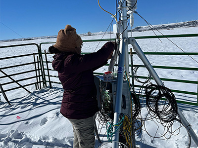
Photo credit: Ivo Zution Gonçalves, DWFI
As part of the project's annual routine, the team sends two members to each site during the growing season for monthly maintenance, and then retrieves specific instruments from the field for recalibration during the winter months. This ensures the accuracy of the data collected by the project's network of ten new "eddy covariance flux towers" installed across Wyoming, Colorado, and New Mexico. Nine of these solar-powered towers are already operational, each equipped with approximately ten sensors that transmit real-time data on CO2 levels, energy balance fluxes,evapotranspiration and other environmental variables. The final tower is scheduled for installation early this spring.
These EC towers, which require about two to three days each to set up depending on the weather conditions and location, collect data at ten readings per second (10 Hz), process the data at the tower and transmit results via cell phone modems. The information is then further processed and made available online for researchers and policymakers. Additionally, the data contributes to Ameriflux, which makes data from field sites representing major climate and ecological biomes publically available.
The Parallel 41 Flux Network project has several key goals. Firstly, it aims to "ground truth" - or validate and calibrate - DWFI's GloDET model, which estimates global daily evapotranspiration using NOAA VIIRS satellite instrument (375 m pixel resolution). Accurate evapotranspiration data are vital for growers, allowing them to precisely apply irrigation water to their crops for optimal yields. In the Upper Colorado River basin other remote sensing based evapotranspiration models will be compared to the flux tower data.
Secondly, the data collected are crucial for understanding the impacts of climate change, particularly regarding CO2 and water balance, and for developing sustainable crop water management strategies. Ultimately, the project seeks to create a tool for improved water resource management that can inform water governance and policy.